Sherlogic Mystery
A storied logic puzzle. Read closely—every detail may matter.
Case File · Read Carefully
The Island That Wasn’t There
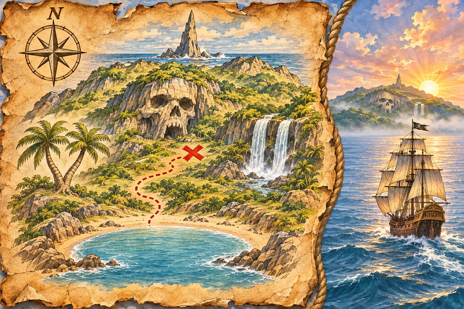
Flint’s Sealed Chart
Captain Redbeard had spent years searching for treasure buried by the notorious Captain Flint. His guide was not a tavern copy: Redbeard had recovered the parchment himself from Flint’s locked chart case in the wreck of the Sea Viper. Flint’s dated log lay beside it and described the same map, the same sheltered bay, and the same red X. The parchment showed five memorable features—a Needle Rock, a Split Palm, Twin Falls, a Skull Cliff, and a Crescent Bay—along with a compass rose and a dotted path to the treasure.
Land at Sunrise
After weeks at sea, the Crimson Gull reached the map’s coordinates. Elias Reed compared the numbers on the parchment with the position written in the ship’s log; they matched exactly. The ship was steering south. The rising sun shone from the port side, and Elias reminded the crew that port meant left: when sailing south, east lay to their left, west to their right, and the island’s north coast was directly ahead. Finn spotted land and shouted, “Island ahead—no doubt of it!”
A Coast That Looked Wrong
Celebration faded as the island drew near. Its outline did not resemble the parchment. The Split Palm, Twin Falls, and Skull Cliff seemed to stand in the wrong order, while the sheltered Crescent Bay was nowhere in sight. Elias lowered his spyglass. “These are the correct coordinates, Captain, but this cannot be Flint’s island.” First Mate Briggs tapped the parchment. “Then the map is a forgery.” Finn shook his head. “I watched the island from the moment the sun cleared the sea. We never changed course.”
Five Checks
Redbeard ordered one careful comparison at sunrise and one at each of the next four bells. Each check used a different observation post—the Bow, Port Rail, Mainmast, Starboard Rail, or Stern—focused on a different map feature, and tested a different explanation: Wrong Coordinates, Forged Map, High Tide, Reversed Compass, or Opposite Coast. At sunrise, Finn worked at the Bow and tested Wrong Coordinates. His feature was Needle Rock.
Rails, Mast, and Bells
The Port Rail check came exactly one bell before the Mainmast check, and the Mainmast check came exactly one bell before the Starboard Rail check. The Stern check occurred later than the Starboard report. Twin Falls were studied from the Port Rail, Skull Cliff from the Mainmast, and the Split Palm from the Starboard Rail.
Theories in Order
The Forged Map theory was tested exactly one bell after Wrong Coordinates. High Tide was tested one bell after Forged Map, and Reversed Compass one bell after High Tide. The Crescent Bay was paired with the Opposite Coast theory. Redbeard also noted that the solid headlands around the bay rose well above the dark tide line; changing water level could not make those cliffs vanish. The sunrise still lay to port exactly where east belonged, so the compass had not been reversed.
The Parchment’s Point of View
Redbeard studied Flint’s artwork again. This was not a flat outline drawn as though seen from the clouds. The palms, cliffs, and waterfalls stood upright, and distant features rose behind nearer ones. The compass rose placed north toward the far upper edge of the scene. The mapmaker had drawn what the island looked like from one particular shore. Complete the five checks, compare the unmatched explanation with the map, and determine why the island before the Crimson Gull seemed not to be there.
Detective’s note: There is no separate clue list. Circle the useful facts in your mind and transfer them to the grid.
Detective’s Deduction Grid
Record the relationships you uncover in the case file.
Eliminate is selected.
LogicPuzzles.com